


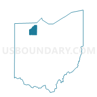
WESTON VILLAGE Voting District, Wood County, Ohio
About
Outline

Summary
| Unique Area Identifier | 653420 |
| Name | WESTON VILLAGE Voting District |
| County | Wood County |
| State | Ohio |
| Area (square miles) | 1.12 |
| Land Area (square miles) | 1.12 |
| Water Area (square miles) | 0.00 |
| % of Land Area | 99.77 |
| % of Water Area | 0.23 |
| Latitude of the Internal Point | 41.34598070 |
| Longtitude of the Internal Point | -83.79460920 |
Maps


Graphs
Select a template below for downloading or customizing gragh for WESTON VILLAGE Voting District, Wood County, Ohio


Neighbors
Neighoring Voting District (by Name) Neighboring Voting District on the Map
- MILTON TWP NORTH Voting District, Wood County, OH
- WESTON TWP WILLOW Voting District, Wood County, OH